Before diving deep into how to use cellular data for GPS Tracking, Imagine a world where obtaining the precise longitude and latitude of your connected devices globally, always up to date, is not just possible, but also energy-efficient and cost-effective. This future is now a reality.
Rather than relying on a GPS module, the location of your M2M device can be found by the SIM card’s connection to mobile networks

Features of GPS Tracking:
1. Tracking History

Tracking the historical positions of your connected device is now seamless. You can monitor the movement of a vehicle, here represented with different colors standing for each day’s route.
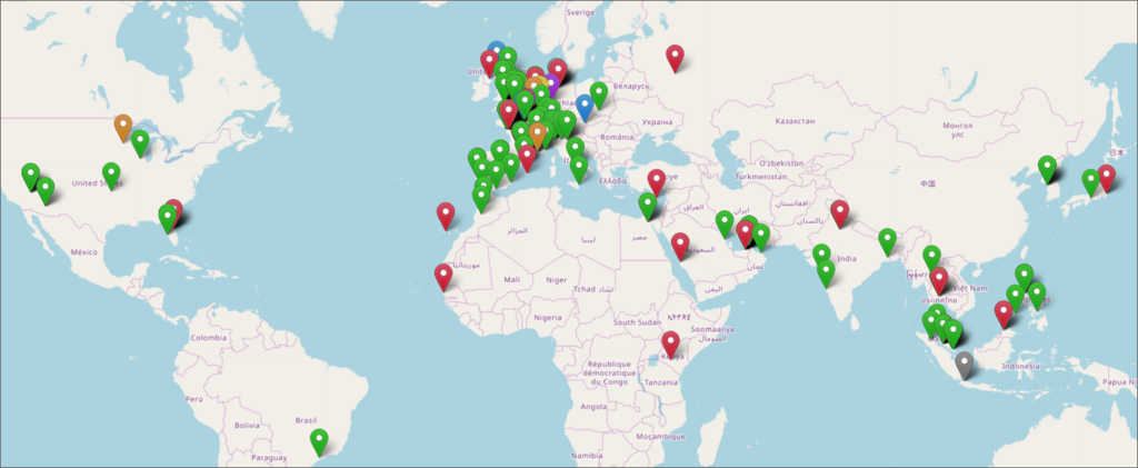
Supervise the position of your entire fleet with an overview of your connected products’ locations.
2. Heatmap
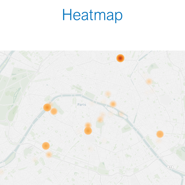
Generate a heatmap of where your devices are connecting from. Darker colors represent more connections from that location within your chosen period.
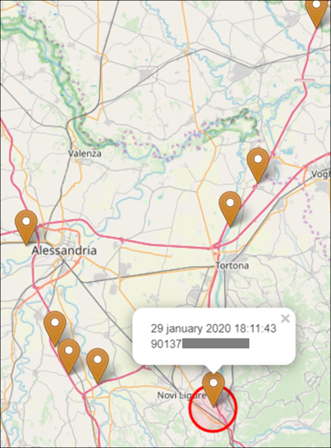
Pinpointing the location of a specific device, the accuracy range is represented by a red circle. In densely populated areas, the precision can be within a few hundred meters, while in sparsely populated areas, it may be within a few kilometers. This variation occurs because the location provided is based on the antenna the device used to connect. The estimated accuracy level is conveyed based on the known density of antennas in the area.
Why choose Cellular Data for GPS Tracking?
- Save on GPS module costs:
the device only needs to connect to mobile networks to be positioned.
- Enhance the battery life of the IoT device:
since there is no need to search for satellite signals and the position is calculated after mobile network communications are generated, the marginal energy consumption (at the device level) needed to position the device is virtually zero.
- Replay the journey:
the positions of the devices can be recorded to provide granularity down to a position log every 5 minutes. This allows for the reconstruction of the movement history of the M2M unit.
- Through the web interface, API, and data files:
each client is unique, so the system has been adapted. The method that better fits the IT environment, practices, and use case can be used.
Transatel’s M2M solutions offer the last known position of a device, a heatmap of all connected devices, or a historical log of positions. Depending on your needs, you will find the most relevant solutions.
Click here to book a free call with one of the IoT Connectivity Experts and learn how Transatel can help you optimize your M2M Fleets.
